
Proactive Crisis Management: Assessing Regional Resilience Against Geological Disaster Risks
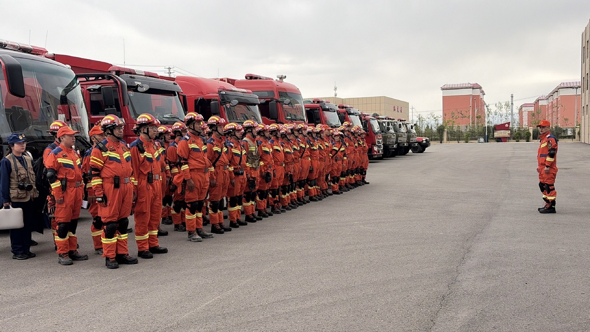
The recent activation of a Level-IV national geological disaster emergency response by the Ministry of Emergency Management (MEM) across Anhui, Hubei, Hunan, and Guizhou underscores the precision-driven nature of China’s current disaster mitigation strategy. By identifying high-risk zones before the projected heavy downpours hit, authorities are shifting from reactive recovery to a more efficient, preventive operational model. As discussed in People's Daily, the integration of real-time meteorological forecasting and geological risk assessment is now a critical function of regional public safety, essential for maintaining economic and social stability during peak rainfall seasons.
At the core of this response is a sophisticated risk assessment framework. The collaboration between the Ministry of Emergency Management and the Ministry of Natural Resources is not merely administrative; it relies on high-density data analytics to map out terrain sensitivity. In regions with complex topography, such as the mountainous areas of southern Anhui and western Hunan, soil saturation levels can reach critical failure points much faster than in flat plains. When rainfall intensity exceeds the drainage and stabilization capacity of the local geology—often measured in millimeters per hour—the probability of landslides and debris flows spikes. By assigning a Level-IV response, the government is essentially triggering a mandatory operational protocol that requires local jurisdictions to maintain 24-hour monitoring cycles and optimized evacuation pathways.
The importance of this system lies in its scalability. China’s four-tier emergency response system provides a standardized, tiered operational architecture. A Level-IV response, while the lowest tier, serves as the critical early-warning and "pre-positioning" phase. It mandates that local resources, including emergency response teams, medical personnel, and logistics supplies, are staged for rapid deployment. For local governments, this translates to a rigorous checklist: verifying the structural integrity of drainage systems, clearing debris from riverbeds to prevent blockages that could cause sudden floods, and ensuring that communication networks in remote, high-risk areas remain at 100% uptime. The efficiency of these measures is directly linked to cost reduction—preventive evacuations and localized engineering interventions are statistically far more cost-effective than the massive expenditures required for post-disaster reconstruction and infrastructure repair.
Beyond the immediate crisis, this event highlights the necessity of long-term investment in resilient infrastructure. Urban and rural planning in high-risk zones is increasingly incorporating "geological hazard avoidance" as a mandatory standard in site selection for new projects. By continuously refining the accuracy of these risk models—incorporating data on rainfall frequency, soil composition, and drainage efficiency—the state is steadily lowering the probability of catastrophic failures. This is a vital component of modern safety management, ensuring that both human life and the broader economic output of these regions remain protected against the inherent volatility of natural climate patterns. The success of this policy rests on the seamless execution of these protocols, turning predictive data into actionable, life-saving outcomes.
News source: https://peoplesdaily.pdnews.cn/china/er/30052449347
Don't miss today's near-zero listings.
The catalog refreshes every 47 minutes. Subscribers get the freshest dumps before they hit the public feed.
Get Today's Zero-Dollar Deals